What to do on my own ?
What to do on my own ?
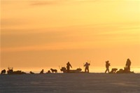
Fishing
Danish expert flyfisher, Steen Ulnits, visited the Ittoqqortoormiit area a few years ago to check out possibilities for flyfishing. Conclusion was that there's many good places for regular rodfishing, but the rivers are too unclear for flyfishing. However, rodfishing is seasonal due to the water level in the rivers.
Link to flyfishing report by Tomasz Mikolajgzyk
You need to buy a fishing license to be allowed to fish in the Ittoqqortoormiit area. The license can be ordered via Nanu Travel Aps or found in post offices all over Greenland. The Arctic char is a tasty fish - a bit similar to trout /salmon. It is fantastic when prepared in open fire, in a smoking oven or on a barbecue.
Shark fishing in the spring is common among local people who need an alternative to dogfood.
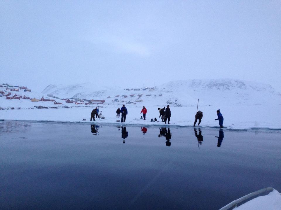
Ice fishing on lakes is also common in the spring. By making a hole in the frozen lake, lowering a string with a hook and a lot of patience , you can fish for little polar cod.
Most fishing equipment is available in the Nanu Travel tourist office .
.jpg)
.JPG)
.jpg)
Kayaking
Experience Greenland from the seaside and enjoy the Arctic beauty and quietness. We have single and double kayaks (with childrens seat and extra equipment) for rental - you can rent on daily basis or longer.
.jpg)
.jpg)
.jpg)
.jpg)
Hiking in the nearby area
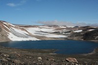
The best time to hike in the areas near Ittoqqortoormiit is in the summer season when the snow has melted. The summer season is approximately from July until October. The weather is not always reliable, and it is wise always to bring equipment in case fog or a storm is comes. Recommended equipment would be: satellite (or cell phone) in case you need to get in contact with someone in an emergency. GPS to help you with the direction , especially in foggy weather where the vision can be very limited. A rifle for self-defense in case you meet an unfriendly polar bear or a musk-ox. A hiking stick can also be a good idea both to support your knees but also to keep balance when crossing a creek. Bring extra warm clothes in case the weather changes. It is always a good idea to bring binoculara. And of course some good sturdy hiking boots are recommended.
Recommended hiking tracks:
Marked with level grade, level 1 is a short and easy track and level 5 is a longer and more difficult track. All the trips below are one day hiking trips, however we recommend that you plan to overnight in Kap Tobin/Unarteq:
- Ittoqqortoormiit to Whalrus Bay, 2 kilometers each way: level 1
- Ittoqqortoormiit to Kap Tobin/Ûnarteq in the winter season, 7 kilometers each way across the sea ice: level 2
- Ittoqqortoormiit to Kapt Tobin/Ûnarteq in summer season, 9 kilometers each way on land: level 3
- Ittoqqortoormiit to Mågefjeld, 5 kilometers each way: level 4
- Ittoqqortoormiit to Gulefjeld, 9 kilometers each way: level 4
Two new hiking routes were established in the summer of 2008 . Both are marked with paint and easy to find if you follow the map you can get in the tourist office. One route leads you to Walrus Bay and return with the new road from the water lake. The second route takes you around Rovmågesø. Maps, a rifle for protection, a grill for preparing dinner and maybe a dog for good company can be bought/rented in the tourist office .
.jpg)
Hiking to Kap Tobin :
Ûnarteq is a settlement seven kilometers away from Ittoqqortoormiit. It is possibly to walk directly to Ûnarteq across the sea ice eight months of the year. You have to hike on land to reach Ûnarteq in July, August, September and October.
If you walk across the ice, it will take you a couple of hours to get to Ûnarteq. It is a good idea to follow the snowsmobile and dog sledge track, because the snow condition is better to walk in. But remember to step aside when a sledge comes along!
If you hike to Ûnarteq over land in the summer season, it will probably take you 5 – 6 hours. You will have to go around the Tele mountain first as there is no shoreline route until the other side. The highest mountain on this route is 270 meters above sea level. The first part from Ittoqqortoormiit to Ûnarteq involves some hiking in the mountains and you also have to cross a small waterfall. The last part is mostly walking by the shore.
It is a very good idea to bring either a satellite phone or a cell phone (connection with the cell phone when you have a view to Ittoqqortoomiit, which you have almost all the time). A GPS is also recommended. Foggy areas are common, especially near the fjord, so the GPS can help you not get lost. It is always important to bring a rifle when you hike, there can be polar bears in the nearby areas both in the winter and summer time. In Ûnarteq you can see tracks from old inuit stonehuts and close to the settlement you will find a small hotspring , which is the warmest in Greenland (62 degrees) . You are welcome to camp in tent in Ûnarteq and the local service building with shower, toilet & kitchen facilities is free of charge for everyone.
Ittoqqortoormiit to Ûnarteq in the winter season, 7 kilometers each way: level 2
Hiking to Gule Fjeld :
Gulefjeld is about 7 kilometres away from the village of Scoresbysund, in walking distance, so its a 14 kilometre hike as a round trip. We were two girls taking the trek , on a very sunny and clear day in August 2005. We wanted to enjoy the walk and surroundings as much as possible so we walked at a comfortable tempo while observing the nature en route. It was a 9 hour hike, including several breaks.
There are in fact two tops to Gulefjeld, so we decided to reach the small top because it has the more exciting stone features, although I can strongly recommend climbing both tops. But if you are short of time, then take the small top. Thousands of years ago Gulefjeld was below sea level and you can therefore see some very amazing sandstone figures and forms on the two tops. The view is spectacular.
During the trip we had to cross about 4 streams, the deepest of which was about ¾ of a meter. We knew that we had to cross some streams so we brought sandals and towels with us, as well as a walking stick which I can highly recommend. The water was extremely cold but it is a nice fresh feeling afterwards. We also discovered that it’s a good idea to hold on to each other whilst crossing the streams, just in case one gets into trouble keeping balance. After crossing the streams we sat down and had a nice cup of hot chocolate and some biscuits.
We took one rifle with us, just in case we met a dangerous animal such as a Polar Bear or a lonely Musk Ox. Some might say, that it is unnecessary to bring a riffle when you are hiking so close to the village, but we were not prepared to take any risks because you never really know what you might meet when you’re out amidst Greenlandic nature.
We also took a satellite telephone with us, so that we could call the town if we got into any kind of trouble and needed help. Finally we took a GPS with us, which is common in very foggy areas, especially near the fjord, so the GPS was just in case the weather changed and we got lost. All these practical things such as riffle, satellite telephone and GPS were items which we were able to rent from the local tourist office ‘Nanu’ and for which we had been giving clear instructions on how to use them.Ittoqqortoormiit to Gulefjeld, 9 kilometers each way: level 4
Hiking to Mågefjeld :
Mågefjeld is 362 meters above sealevel. It is a mountain in the Whvalrusbay. You can hike to Måge Fjeld and back to the village in 4 – 5 hours. The distance is about five kilometers each way. Mågefjeld has a spectacular view over Rosenvinges bay, where the village is located. You start the trip following the creek in Ittoqqortoormiit, you will see that there are a fine road to follow. It is important what you stay on the left side of the creek. You will pass a small lake, which is the waterlake, supplying the village with water. When the road stops you keep on walking for about one kilometer, until you reach a snowslide then you turn left and you will see Mågefjeld. It is best to climb Mågefjeld from this direction, it is too stealth on the other sides. When you reach the top, then hike all the way to the left edge, and there you will have a very nice view over the bay. Remember all safety equipment for the hikingtrip. Maps can be bought in the tourist office.
Ittoqqortoormiit to Mågefjeld, 5 kilometers each way: level 4
.jpg)
.jpg)
.jpg)
.jpg)
Activities in the snow
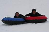
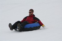
Snow tube :
Rent a snow tube for a day and have great fun in the surrounding snowcovered mountains . If you want even more speed , you can hire a scooter + driver to help you
Skiing :
The best time to ski in the area near Ittoqqortoormiit is from January to June, especially April and May is a perfect time, since the snow conditions are good, weather is bright and often very sunny during the day. The temperature is also nice in these months.
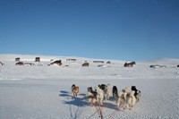
If you are interested in downhill skiing, then you will find some good mountains and glaciers in the nearby suroundings. If you want to do crosscountry skiing, then you will find many good both short and long distance routes. You can choose to ski to the nearby settlement Igterajivit (Kap Hope) or Ûnarteq (Kap Tobin). There are several small cabins in the Scoresby Sund region and you are welcome to use these huts for camping. In Hurry fjord you can find cabins at Kap Stewart, Dombrava and Kalkdalen.
Recommended cross-country skiing routes:
Marked with level grade, level 1 is a short track and level 5 is a longer and more difficult route. The skiing routes listed below are meant for one, two or three days skiing trips:
- Ittoqqortoormiit to Ûnarteq, 7 kilometers each way: level 1
- Ittoqqortoormiit to Igterajivit, 11 kilometers each way: level 2
- Ittoqqortoormiit to Kap Swainson, 15 kilometers each way along the shore: level 3
- Ittoqqortoormiit to Kap Stewert, 18 kilometers each way: level 3
- Ittoqqortoormiit to Dom brava, 25 kilometers each way: level 4
It is not possible to rent downhill/cross country skis in the tourist office , but we do provide visitors with skis if they wish to ski next to the sled on our sled trips.
Snowshoes :
Rent snowshoes on day basis in the tourist office and experience Greenland in a new way! Snowshoes are an excellent way of getting forward when the snow is deep and soft.
Sightseeing in the local area
The hot spring in Kap Tobin :
In the Ittoqqortoormiit area you can find hot springs several places , but the one in Kap Tobin is the warmest spring in Greenland . The spring can be visited year around , whatever you go there on foot , by boat or by dogsled . The hot spring is not geysers like you may have seen it in Iceland , but its a little pool with a maximum of temperature of 62 degrees .
If you are tough , you will take a short dip in the spring in winter . When pouring snow in the spring , you can lower the temperature so the water is suitable for a dip.
The spring is marked on the maps of the local area , which you can purchase in the tourist office.
The Walrus Bay :
This is truly an arctic riviera in summer . The blue sea , the endless beach , people fishing arctic char in the lake , children swimming in the river …!
An American base was established here after the second world war and the ruins still remains . For visitors with historical interest , the ruins is worth a visit .
Years ago , the bay was inhabited by a walrus colony . Photographs from back then can be seen in the local museum .
The bay is still a paradise for wildlife . Almost every year lonely musk oxen can be seen in the bay – you should be aware of them , since a lonely musk ox can be dangerous . But observing a musk ox from a safe distance is a great experience . Once in a while , polar bears also stops by the bay . So always carry a gun when trekking in the bay .
Foxes and arctic hares can be seen in the bay year round and if you are lucky , you can get very close to them . Several places in the bay you can find old fox trappers , which is a quite simple system used in the old days to catch foxes .
A few year ago , a road was build between the bay and the town . This means that you can walk from town to bay in about 20 minutes . You are welcome to camp in the bay in tent – there’s a freshwater river and lots of dried wood for building camp fires . A fishing license can be arranged via the tourist office .
During summer , there’s often activities in the bay . The youngsters play football , the old hunters sits next to the road all day , waiting for seals in the sea , local people are fishing with rod and net in the sea or the lake , families are having barbecues at the beach and people are camping in the area .
The bay has a multitude of arctic flora , berries and even mushrooms .
Gule Fjeld/The Yellow Mountain :
At the opposite side of the Walrus bay , “the yellow mountain” raises in the distance . For trekking , this is a wonderful daytrip and besides of the funny shaped sandstones you can find on top of the mountain , you will have a wonderful view over the bay and the town. Thousands of years ago Gule fjeld was below sea level and you can therefore see some very amazing sandstone figures and forms on the two tops. The view is spectacular.
The Ice Edge :
The entrance to Scoresby Sund is generally ice-free year around as a result of currents flowing into and out of the fjord. This generally open water is termed a polynya, and it has been a major factor in controlling the distribution of marine life in the fjord and the explotation of them by native people. Scoresby Sund starts to freeze over in November. The ice has a relatively smooth surface and may reach a thickness of up to 2m. There is often a clear border between the fixed fjord ice and the moving pack ice. This is called the ice edge or “iskant”.
Year around , the hunters hunt from the ice edge . Depending on weather and conditions , different kinds of seals , birds and even whalrus can be seen here . Seals are a common sight and after a good day at the edge , the hunter sometimes brings more than 5 seals home . Whalrus is a more rare sight – according to the old sayings , there’s a whalrus around if the seals are gone . Narwhales are passing by the edge several times a year . As all other marine animals , they hardly make any noise - suddenly they are there and just as sudden , they have moved on .
Polar Bears are sometimes wandering along the edge from Kap Tobin and if you are lucky , you can spot one from far away . You can rent a rifle in the tourist office , so you can feel 100% safe during the trip .
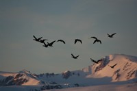
Year around , there’s ravens , ptarmigan and black guillemots in the area . From the end of April , thousands of little auks enters the edge ; razor-billed auks and mallards are also a common sight .
.JPG)
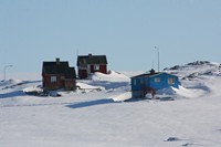
The villages of Ittoqqortoormiit :
By Ib Lorentzen & Karina Bernlow
When the colonists arrived at the new spot in 1925, they were split between the town and 3 other places, which seemed to be good for hunting. The idea was to establish a good foundation for hunting as soon as possible, so the 70 colonists were divided between Scoresbysund / Ittoqqortoormiit, Kap Stewart / Tsiarngagai, Kap Tobin / Uunartoq and Kap Hope / Ittajimmiit. During the World War II, a few families also moved to Sydkap / Karngerstua, which even had a trading station, besides a few houses.
Kap Stewart / Tsiarngagai
Established in 1926. A few houses were built here, and today 2 of the houses still remain. Kap Stewart was deserted soon after that, but during World Way II, it was permanently occupied . Since then, Kap Stewart has often been used as a seasonal trapping station, along with Sydkap, Stewart Island, Fame Islands and others. Even today Kap Stewart is used by hunters, for overnighting and hunting. Lots of fossils can be found at the beaches near Kap Stewart .
Kap Hope / Ittajimmiit
Established in 1926. A few families moved out to this spot, which quickly turned out to be excellent for hunting. The first houses were “peat-houses”, built up with wood, and insulated outside with peat. These houses had just a single window, and a door leading out to a separately built porch. The houses were 16-20 square meters and most of them had only one big room. Some also had a little porch outside, which was used for toilet, seal-keeping and general storage. The main room had a big mattress, on which most of the family could sleep. The house had no running water or electricity, and a coal stove was used for cooking and for heating the house. Often a family had 5-6 children – one family in Kap Hope had more than 20 children.
Until the 1960s, Kap Hope was inhabited by at least 15 hunter families, but from the middle of the 60s the village was slowly deserted. A lot of the adult inhabitants of Ittoqqortoormiit today, grew up in either Kap Hope or Kap Tobin.
As a hunting society, Kap Hope was bigger than both Ittoqqortoormiit and Kap Tobin. A combined church and school was built, along with a little store, and Kap Hope also has its own graveyard.
Today Kap Hope does not have any permanent residents, but a lot of houses remain. There’s still a small school and a store, and the possibilities for good hunting are still excellent.
None of the peat houses exist today, but in the local museum in Ittoqqortoormiit, you can see the remains of “Elionora’s house”, which came from here.
Several Eskimo ruins can be visited in Kap Hope.
Kap Tobin / Uunartoq
Established in 1926. A few hunter families also moved out here , to live in pre-built peat houses . Until the end of the 1970’s Peter Brønlund and family still occupied a single peat house and managed living without running water, electricity or central heating. In that house, Peter and his wife raised about 7 children.
When the combined Weather & Radio Station was established in 1947, the number of hunter families slowly decreased, but a few families remained, and one hunter family was still living in the village in 2004.
Along with the Weather Station, a lot of employees and their families arrived. The station employed about 20 people, and each one brought their wife and family of about 3-4 children. When it was biggest, Kap Tobin was inhabited by about 120 people.
There has never been a church, a store or a doctor in Kap Tobin, because it is situated only 7 kilometers from town. But, because of the great number of children a school was established, and a teacher was employed until the last family moved out in 2004. A medicine box was rotated around the employees from the station, and for this job the “doctor” for each month was paid a sum of about 60 DKK.
The weather-station itself had electricity from the beginning and, by the 1980s, most of the houses in the village also had both electric light and power. This was before even Ittoqqortoormiit town was blessed with electricity and telephones.
Today nobody resides permanently in Kap Tobin, but most of the houses are owned by inhabitants from Ittoqqortoormiit, who use them as summer houses. In Kap Tobin you also find Eskimo ruins, and furthermore the warmest hot springs in Greenland (at 61.8 degrees)
.JPG)
Sightseeing in Ittoqqortoormiit
The Museum :
Ittoqqortoormiit Kalersungaasiviat / Ittoqqortoormiit Lokalmuseum.
By Hanne & Birger Sandell , Eskimologists
In 1995, the Greenlandic Homerule handed over one of the town’s oldest houses to Ittoqqortoormiit Kommunea, for use as a local museum.
On 4th September 1997 this local museum was officially opened. The house, which was built in 1930, was formerly the KGH ( Royal Greenlandic Trading) store for many years . Later it was taken over by GTO ( Greenland’s Technical Organization ): after a sympathetic renovation, they used the building as their office.
The permanent exhibition in the museum is from a house ( Eleonorap Ittersua / Elionora’s house) in the village of Ittajimmiit / Kap Hope, with one room where you can see what a hunter’s home looked like in the 1950s/1960s, and how people were living by then.
In the other room on the ground floor, photos of people from the same period are exhibited. These photographs were taken by Ib Tøpfer , who used to work at the telephone station in Kap Tobin. This room is meant to become a frame for changing exhibitions, and so far there have been exhibitions of work by various artists, including Åge Gitz-Johansen and Inger Lise Westman.
On the floor upstairs is a large collection of wonderful photos on permanent exhibition, partly from the town’s foundation and colonization in 1924-1925, and partly from the early years in town. Furthermore there is the “skeleton” from a kayak, and suits worn by Eastgreenlandic men and women. Here also is a great collection of oil-paintings from the period 1957-1959 , painted by the first qualified Doctor in town, Jens Nielsen .
Openinghours : The museum is managed by the school and the tourist office and can be opened after appointment .
The Church :
By Hanne Sandell , Eskimologist
The population of Ittoqqortoormiit / Scoresbysund are Christian (Lutheranian ) .
The adult inhabitants had in 1925 been baptized during the period 1900-1921 in Ammassalik , but very few of them had been in touch with Ammassalik and thereby the mission . So in spite of the baptism , a lot of them had kept some of their old religion.
The colonists had wanted to bring a priest along to the new place , because of insecurity to the new surroundings . This insecurity was not only caused by ignorance to the new surroundings and its hunting possibilities , which people now was about to learn ; it was also caused by the supernatural forces , lying in the nature . The west greenlandic Sejer Abelsen , Catechist ( a native person , who both works as a teacher and a helping priest at the missionary station ) in Kulusuk , was going to be the new priest of the new colony . To be able to maintain his functions at the new place , it was necessary during the journey from Ammassalik to Ittoqqortoormiit , to pass by Iceland , so he could take his holy orders .
Originally , there had only been build one big building for the administration , which contained habitations for the colony controller and the priest , separated by a smaller store , which split the building into two parts . The church affairs was therefore taking place in the priests living room , which originally was meant to be a supply store .
A major wish from the inhabitants , made Ejnar Mikkelsen start a money collection for a church in Scoresbysund . An announcement in the Danish press resulted in that Court Official Valdemar Uttendal offered to give the new colony a church and in the summer of 1928 the new church was finish build , with a priest habitation in the first wing and a school room in the other .
Today there is a service in the church every Sunday and extra services , during festivals .
After appointment , it is possible to make the priest open the church for the public .
.JPG)
.JPG)
.JPG)
.JPG)